Virginia Earthquakes
August 23, 2011, Mineral Virginia Earthquake & Aftershocks
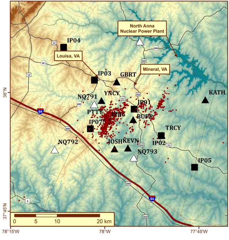
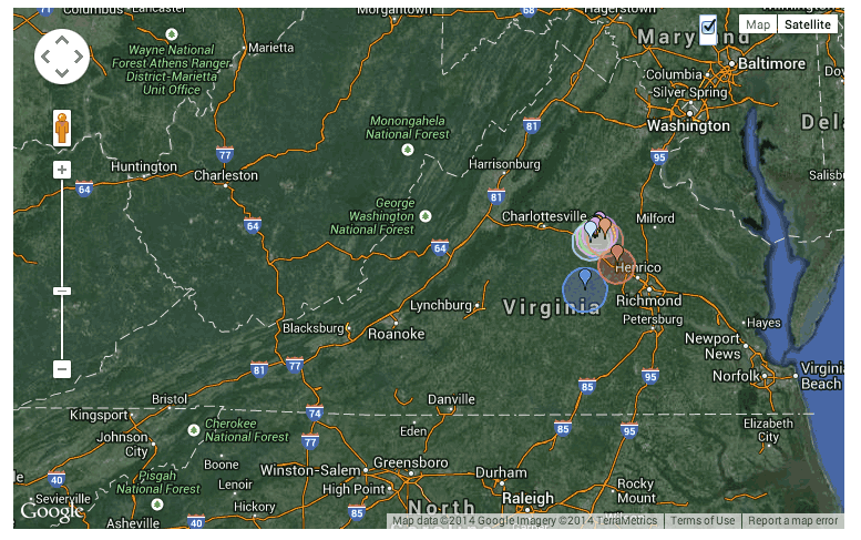
The Mineral earthquake had a very prolific aftershock sequence, which is still being studied. In the days following the earthquake seismologists from VTSO, University of the Memphis, Columbia University, Lehigh University, IRIS and the U.S. Geological Survey installed many seismograph stations in the epicentral area. The small red symbols show the epicenters of 876 aftershock epicenters occurring from August 25, 2011 until January 1, 2012 (Wu and Chapman, 2013). The black symbols show the locations of temporary seismic stations deployed to record the aftershocks.
More information coming soon.
References:
Wu, Qimin and *M.C. Chapman* (2014). Automatic detection and hypocenter determination of the August 32, 2011Mineral, Virginia earthquake aftershock sequence, /_Seismological Research Letters_/, 85, p. 241.
McNamara, D.E., H.M. Benz, R.B. Herrmann, E.A. Bergman, Paul Earle, Anne Meltzer, Mitch Withers and *Martin Chapman*, (2014). The Mw 5.8 Virginia, earthquakes of August 2011 and aftershock sequence: constraints on earthquake source parameters and fault geometry, /_Bulletin of the Seismological Society of America_/, 104, 40-54.
*Chapman, M.C.,*(2013). On the Rupture Process of the 23 August 2011 Virginia Earthquake, /_Bulletin of the Seismological Society of America_,/103, 613-628.
A Brief History of Virginia Earthquakes
More information coming soon.
Earthquakes Recorded in Virginia: A Primer
In the theory of plate tectonics, the earth's outermost layer is composed of plates that move relative to each other. Most of the world's earthquakes occur at the plate boundaries. Since places like the California coast are on a boundary between two plates, they have many more earthquakes than places like Virginia, which is near the center of the North American plate (Figure 1a). Yet earthquakes still occur in Virginia (Figure 1b).
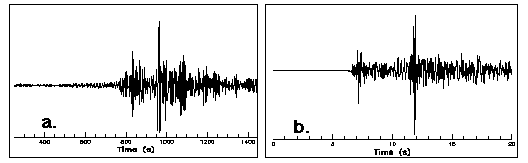
Figure 1: (a)Seismogram of the January 17, 1994 Northridge earthquake, magnitude 6.8. (b) Seismogram of the January 22, 1995 Pulaski earthquake, magnitude 2.9. Both events were recorded on a seismograph in Blacksburg, Virginia.
Virginia has had over 160 earthquakes since 1977 of which 16% were felt. This equates to an average of one earthquake occurring every month with two felt each year. Click here for a summary of the largest earthquakes in Virginia.
Until the magnitude 5.8 earthquake in 2011, the largest earthquake to occur in Virginia was the 1897 magnitude 5.8 Giles County earthquake. This earthquake is the third largest in the eastern US in the last 200 years and was felt in twelve states. Click here for a discussion on the observed effects of this event.
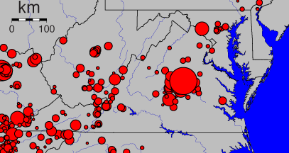
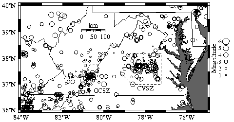
Seismic activity (seismicity) has been known for several decades to be strongest in and around Giles County and in central Virginia. This led researchers at the VTSO to concentrate seismic monitoring stations in these two areas, as shown in Figure 2, which shows earthquakes (circles, scaled to) in and near Virginia from 1774 through 1994.
Useful Links
More information coming soon.